
Event site planning
Plan, draw and collaborate on event site layouts
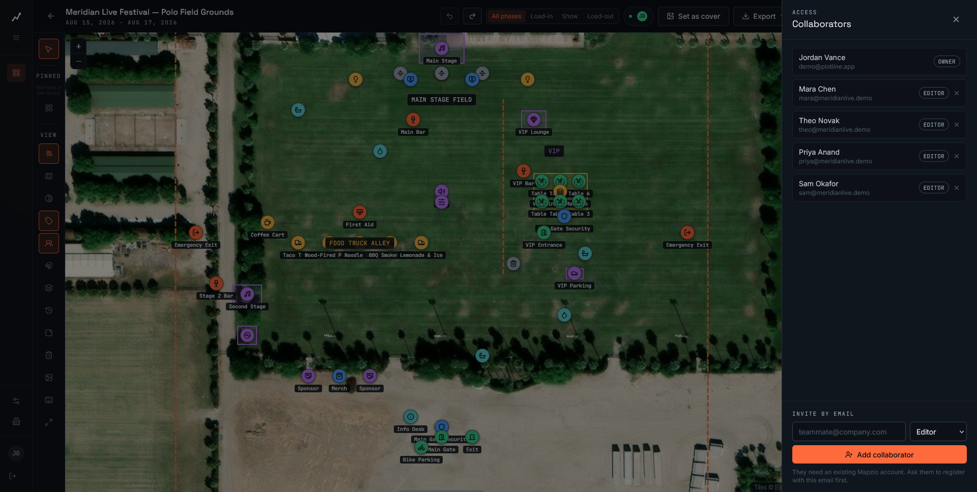
Satellite-accurate site plans, live collaboration, and exports your whole team can use — from festival grounds to ballroom floor plans.
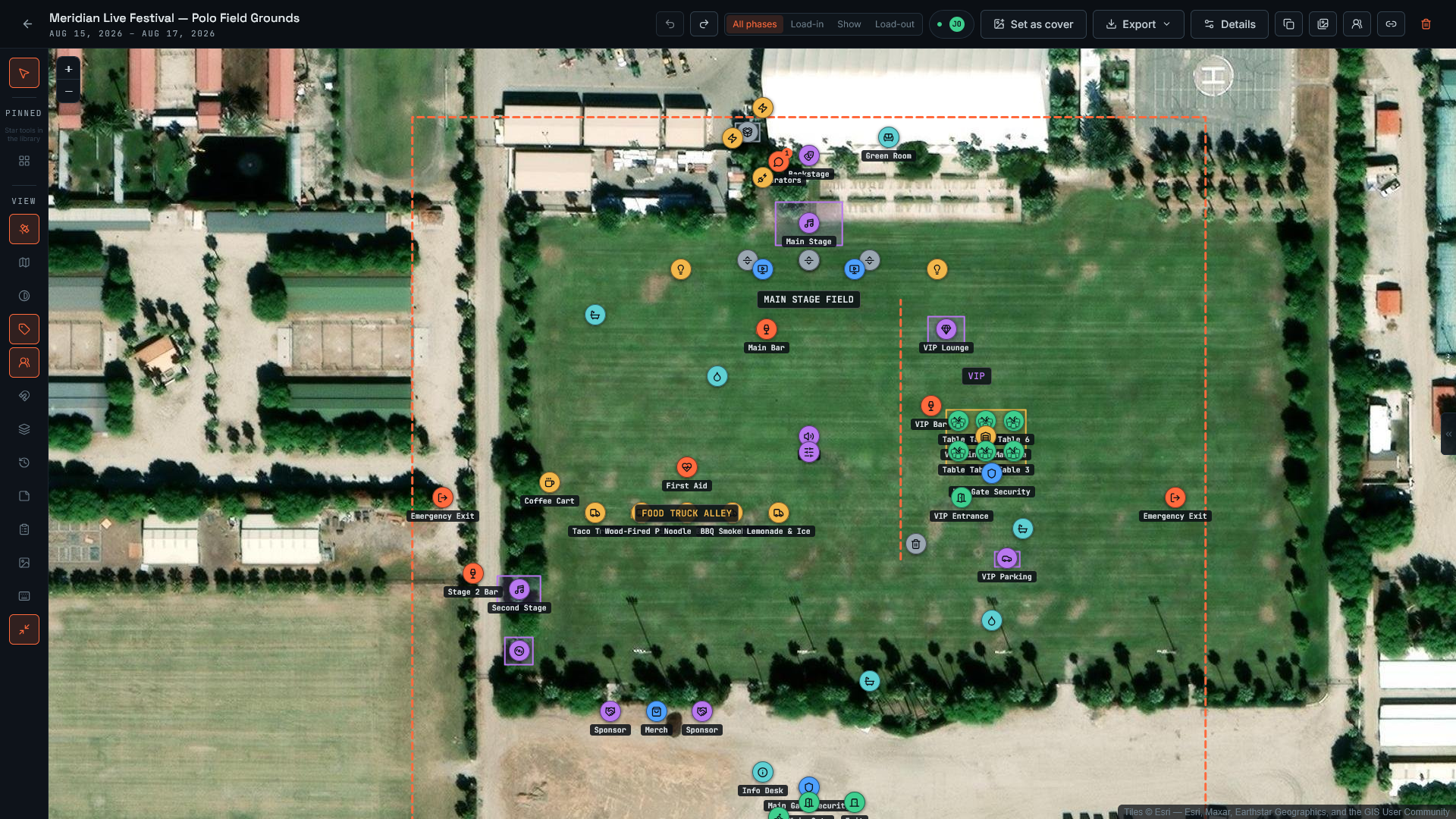
- Real-time collaboration
- Satellite-accurate site plans
- Floor plans for any venue
- Permit-ready PDF exports
How it works
From blank map to permit-ready plan
- WP·01
Drop your site on the map
Search any address or upload a floor plan, then draw stages, tents, barriers and paths to scale.
- WP·02
Invite your team
Everyone edits together in real time — see cursors, comments and changes as they happen.
- WP·03
Export what you need
Generate permit-ready PDFs, shareable links, or high-res images for vendors and security.
Why teams switch
Built for how event production teams actually work
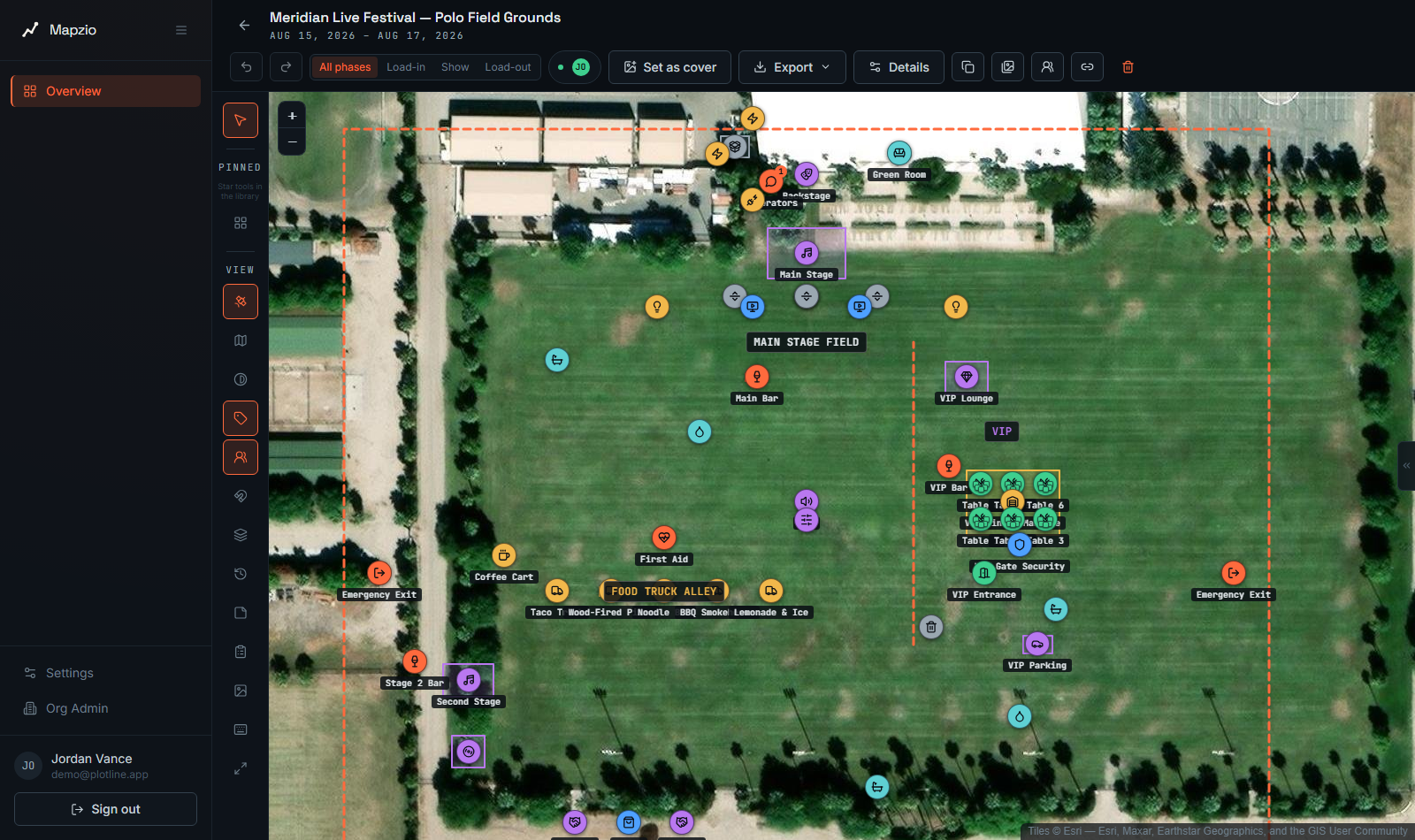
Satellite-accurate site plans
Draw directly over real satellite imagery so every tent, stage and barrier lines up with the real world — no more guessing distances.
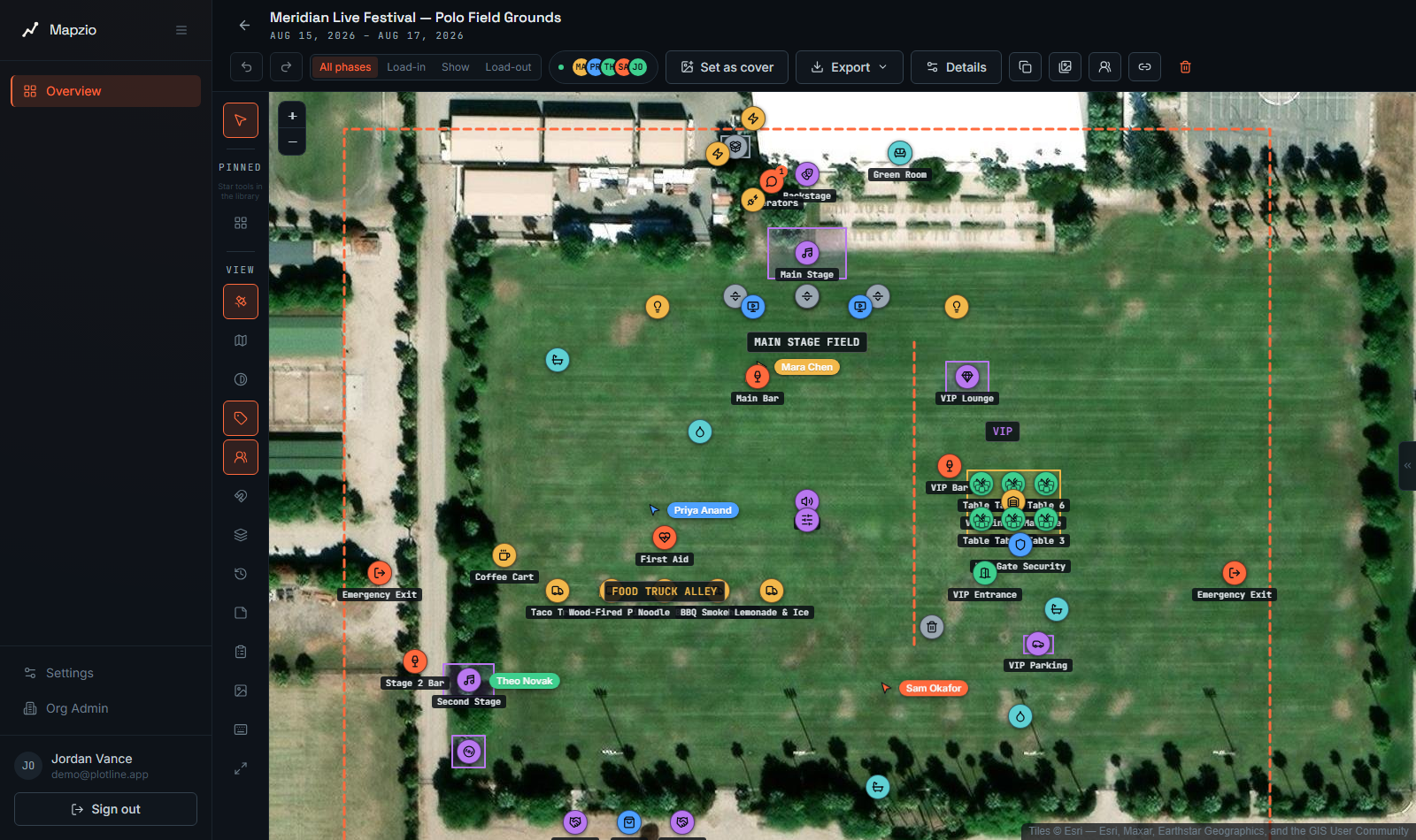
Real-time collaboration
Work with your whole production team at once. See cursors and edits live, no more emailing PDFs back and forth.
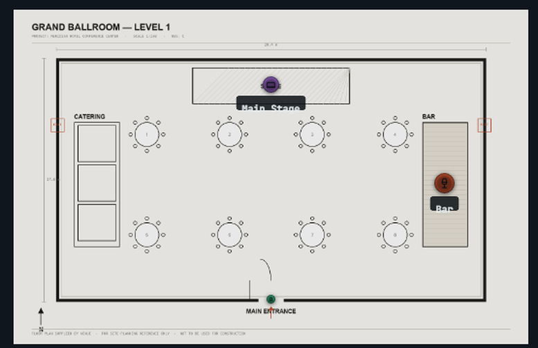
Floor plans for any venue
From open festival fields to indoor ballrooms, switch between satellite and custom floor plan backgrounds in one project.
Permit-ready exports
Export clean, labeled PDFs and images that your local authority, security team or venue will actually accept.
Questions
Frequently asked questions
Is Mapzio free to try?
Yes. You can create an account and start drawing your first site plan without a credit card. Paid plans unlock larger teams and additional exports.
Can my whole team collaborate at the same time?
Yes — Mapzio is built around live, real-time collaboration. Everyone on your team can view and edit the same plan at once, and you'll see each other's cursors and changes instantly.
Does it work for indoor venues, not just outdoor festivals?
Absolutely. Alongside satellite-accurate outdoor site plans, you can upload a custom floor plan image for ballrooms, halls or any indoor venue and draw over it the same way.
Can I export my site plan for permits?
Yes. Mapzio exports clean, labeled PDFs and images sized and scaled for permit submissions, security briefings, or vendor coordination.
Do I need GIS or CAD experience?
No. Mapzio is designed for event producers, not surveyors — if you can use a drawing tool, you can build a site plan.
Is my data private and secure?
Your plans are only visible to people you invite to your organization. We use industry-standard encryption in transit and at rest.
Ready to plan your next event?
Draw your first site plan in minutes — no credit card required.
Start planning free